


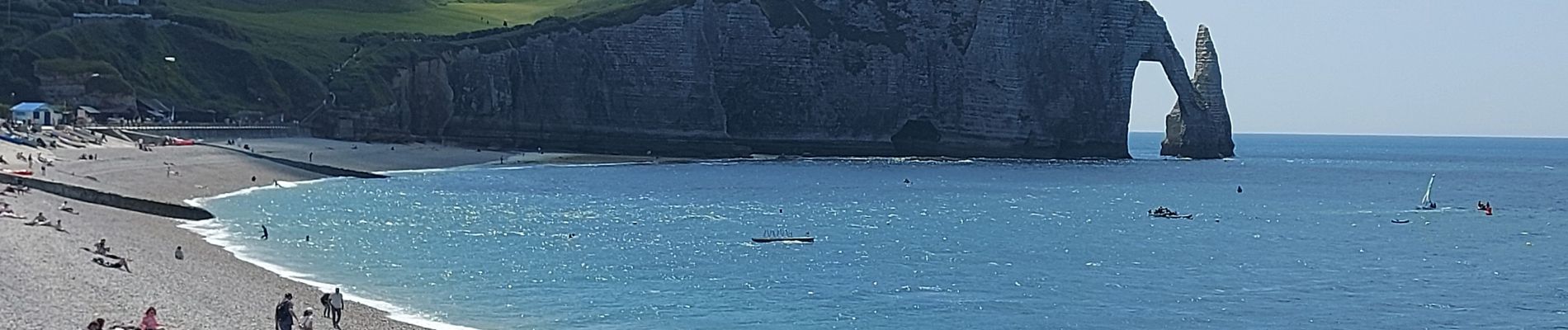
20250611 Le Tilleul Etretat Benouville

Childebert
User
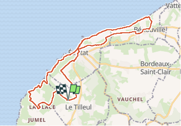

Length
21 km

Max alt
108 m

Uphill gradient
376 m
Km-Effort
26 km

Min alt
3 m

Downhill gradient
376 m
Boucle
Yes
Creation date :
2025-06-11 07:15:04.764
Updated on :
2025-06-11 16:09:53.622
7h33
Difficulty : Difficult

FREE GPS app for hiking
 SityTrail
IGN / Geographical institutes
SityTrail Plus
The world is yours!
About
Trail Walking of 21 km to be discovered at Normandy, Seine-Maritime, Le Tilleul. This trail is proposed by Childebert.
Photos

Positioning
Country:
France
Region :
Normandy
Department/Province :
Seine-Maritime
Municipality :
Le Tilleul
Location:
Unknown
Start:(Dec)
Start:(UTM)
297783 ; 5507535 (31U) N.
Comments